Submissions closed Sunday 15 September.
This consultation has closed.
Feedback and information from the community was reviewed and analysed by consultants and presented to Council and its Floodplain Risk Management Advisory Committee in February and March 2025.
Next steps
The next stage of the project involves the modelling of design events and provision of information to support decisions on activities on the floodplain and managing flood risk.
Background
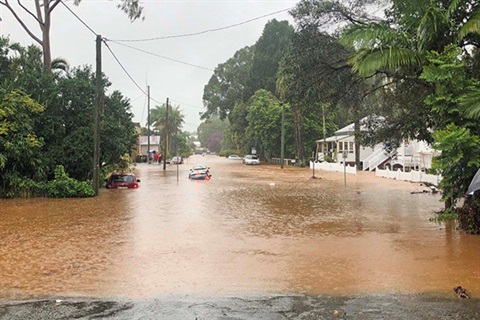
The Bangalow Flood Study will investigate how and where floods, especially those in 2022, impacted the town and nearby areas.
The study will be a technical analysis of flood behaviour, with the information to be used for a range of things including flood risk management and land-use planning for existing and future development.
We asked Bangalow residents about their experiences with flooding. For example:
- Flooding in streets, parks, across roads, bridges, homes and yards etc
- How high the water was
- How fast it was moving
- Was flooding caused by heavy rain, stormwater drainage or the creek.
We are hoping that people may also have information or photos of flooding in Bangalow that they can share to visually support the technical work the consultant is doing.
All information provided will be confidential.
Thanks to Team Piccabeen and residents who have given us permission to use these photos.
Next steps
See the project timeline for more information.