This consultation has closed.
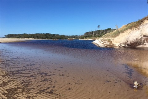
Belongil Creek is an ICOLL, an intermittently closed and open lake or lagoon that opens and closes to the ocean.
There are 70 ICOLLs in NSW and two in Byron Shire:
- Belongil Creek
- Tallow Creek
These two creeks open and close to the ocean depending on the build-up of sand at the mouth of the creek.
They are important ecosystems sustaining fish, birds, marine life, vegetation and wetlands. They are also highly significant cultural use places for the traditional owners of this land, the Bundjalung of Byron Bay (Arakwal) people.
Until recently Belongil Creek had been flowing into the ocean for approximately 12 months and now that it has closed the water is not draining.
We understand that there is a high level of anxiety in the community about the potential for flooding after the weather event in March this year.
Why don't we open the creek?
ICOLLs like Belongil Creek are complex environmental systems and there are strict NSW Government regulations relating to any artificial opening because of the potential impact on fish and other marine creatures.
Council only has a licence from the NSW Government to open Belongil Creek for flood mitigation and to do this there are other factors that need to be taken into account such as forecast rain, and ocean conditions.
We are keeping a close eye on the situation and should the situation change, or if heavy rain is forecast, things will be reassessed.
Share your information
We are interested in the water levels in different parts of the Belongil catchment and creating an email data base so we can communicate with people directly.
Share your information