Floodplains
We are responsible for managing flood risk in the Byron Shire.
We have four major floodplains in the Byron Shire.
For each of these there are floodplain management studies and plans.
These studies and plans:
- aim to reduce the impact of floods on the community
- consider the risk and consequences of flooding
- take into account social and environmental issues associated with flooding.
Floodplain risk management process
- Flood Study: Determines the nature and extent of the flood problem and flood risks.
- Floodplain Risk Management Study: Evaluates management options for the floodplain in respect to both existing and proposed development.
- Floodplain Risk Management Plan: Involves formal adoption by Council of a plan of management for a floodplain.
- Implementation of the Plan: Construction of flood mitigation works to protect existing development. Use of Development Control Plans and Local Environmental Plans to ensure new development is compatible with the flood hazard.
NSW Government Post 2022 Event Flood Behaviour Analysis
The NSW Department of Climate Change, Energy, the Environment and Water has published all of its Post 2022 Event Flood Behaviour Analysis Reports on the NSW SES Flood Data Portal.
The Reports aim to understand the areas impacted by the flood event and determine the current approved flood model's ability to replicate the 2022 event.
For more information visit Flood Planning and Management Studies
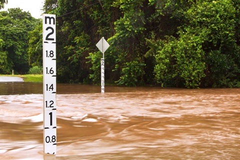
Flood warning system
We have a flood warning system that provides the Bureau of Meteorology, SES and Council with rainfall and creek level data 24 hours a day, seven days a week.
This has been developed alongside an Emergency Dashboard, which hosts emergency information from Council, SES, RFS, BOM and other key information such as road closures.
Visit the Emergency Dashboard